
Day 5: Atrå church - Mæl church
Length: 12,5 km/up: 630 m/down: 660 m
Nature of the path: Gravel roads, good forest paths, old forest paths, at the end 4 km partly steep, rocky path down in the forest (partly hardly a path) – good shoes required


red point: pilgrims bench

Directions
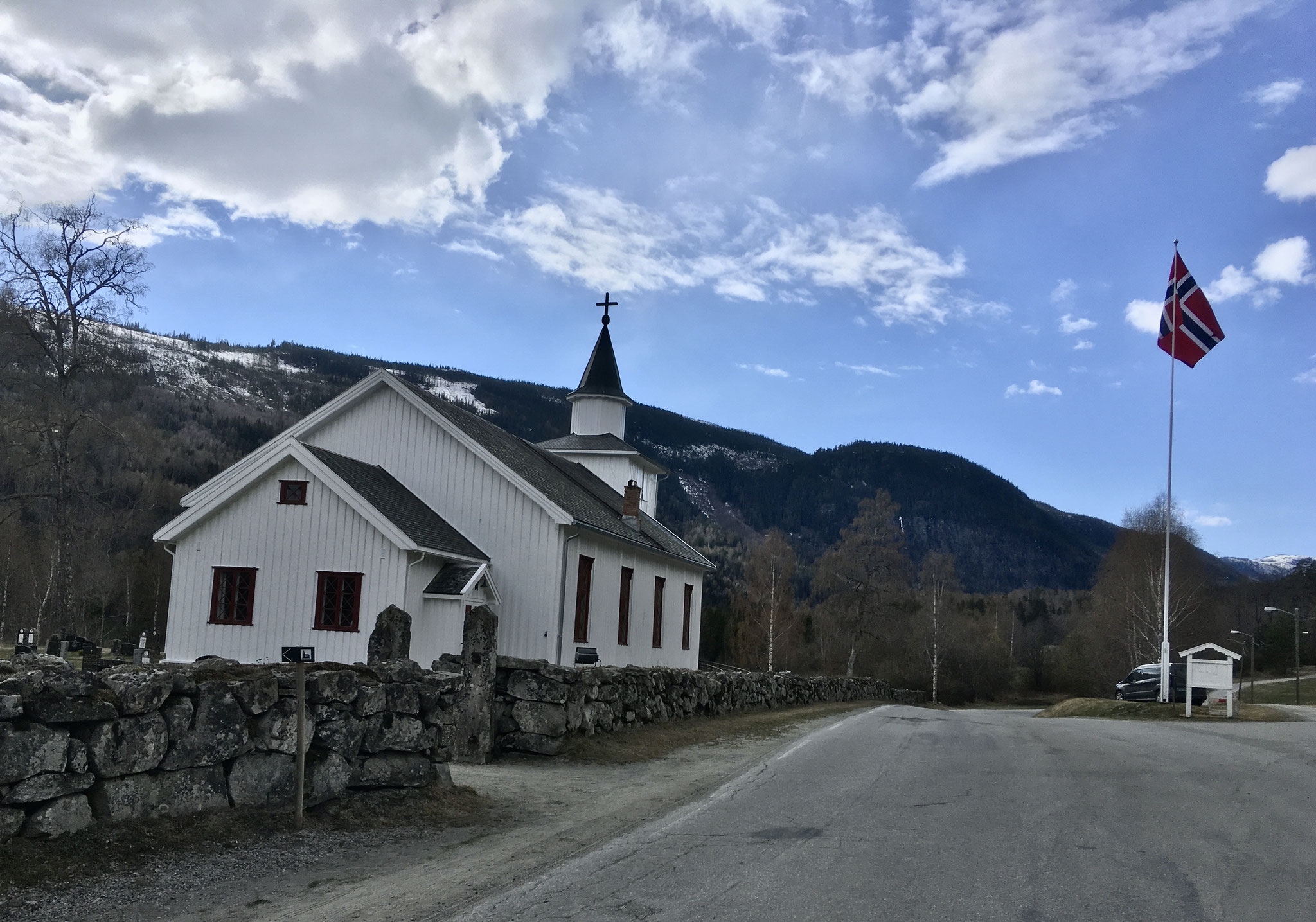
From the church in Atrå, follow an old path along the cemetery wall down to the road and turn right there. Follow the road first over a bridge and then for about 500 m in the direction of Rjukan before turning right at a sign and shortly afterwards to the left again, on a gravel road.
The gravel road leads you uphill. In a pointed turn, you leave him and follow a grass road straight ahead. Shortly afterwards you will pass an old Stabbur again, while the path continues on a steady ascent. A sign indicates a “carry path” which you follow further upwards. Here you will find a large number of fallen trees that make the path impassable. We have marked a path through the forest below the spot for you, which will take you back on the path behind the spot.
A little later a forest path runs parallel to your path. You remain on your path, which is endowed with beautiful edge stones. You can still see here very well how the paths were built and secured earlier. When the “carriage path” turns into a wide forest path, you will see a sign leading you to the left. Follow the forest path uphill, but don't forget to turn around from time to time to enjoy the beautiful view back to Atrå and over to Austbygde.
When the forest road hits a wide road, a sign indicates that you have already gone uphill for 3 km (in real terms already 4 km) and that you are still 7 km to Mæl in front of you. The track soon passes into a relatively new connecting route.
This route was built for the “Tinnløypa” (ski trail in winter), which runs from Gvepseborg to Atrå and is also part of the “Telemarkhelten” bicycle race. At the end of the connecting path you meet a gravel road again and the sign points you to the right, a last piece, up the mountain. At the top of the ridge, through the trees, you can enjoy beautiful views of the Tinnsjø. After 8 km you have now reached the highest point of this stage with 850 m. For a well-deserved break, after the long climb, we have set up a simple resting place with a wonderful view over the Tinnsjø and from here we go downhill.
On the ridge you now pass the “Menkhus”, this is a “Fellesbeite”. These are pastures that share several farms from the valley for their animals in summer. You follow the path, now with a view of the Gaustatoppen and slowly descending until you, on the right, pass a barn. A little further down you see a sign that leads you to the left on a narrow path into the forest. From here the path is marked with red color on the trees. There are now 4 km, partly steep descent in front of you. The path that follows through the forest requires sure-footedness and possibly a little talent for climbing. It is always possible to tilt the trees over these old paths or grow faster than we can cut them. The path partly runs almost through wilderness, where you have to stick attentively to the red markings. The further you come down, the better it becomes and runs along the ancient paths on which the farmers led their animals up to the “Fellesbeite”.
Above the church you come to a beautiful viewpoint, called Håmaren, from which you can enjoy a beautiful view into Vestfjorddalen and thus towards Dal and down to the church and in the background the ship dock of Mæl. The day’s target is thus within reach. There are still a few hundred meters of path down and two gates before you get down to a road. You follow to the right and soon you see the church of Mæl on the left, above the Måna.
(You will reach the campsite as you see the church again on the road and turn right downhill towards the country road between Atrå and Rjukan. At the road you turn right again and at the crossroads to Notodden turn left, then you will see the campsite on the right)
Attention
Since this stage leads up to 850 m altitude you should only go this stage from June to September (see also the film below)
In May we still encountered snow on the paths and streams swollen by the melt of snow. It was sometimes very difficult to overcome them dry foot.
It is also important on the path down through the forest to pay close attention to the red color markings and the white churches markings, as it is always possible for trees or branches to fall over the path.
The pilgrimage route for you often on old paths, like this one, around the Tinnsjø. The video should give you a little impression of these paths. They are exhausting to go but leave a lasting impression. On the film you can also see how the melting of snow in May influences the paths. For example, you will hardly notice this creek in the summer.