
Day 4: Austbygde to Atrå church


Length: 11,8 km/up: 280 m/down: 250 m
Nature of the path: Gravel roads, good forest paths, old forest and church paths, some very steep and uneven up with great view over the lake Tinnsjø

Purple arrows: Austbygde: Kiwi – grocery market, bakery, bank
Atrå: Spar - grocery market
Green arrows: Austbygde: Sandviken Camping
Red arrows: Atrå: Crafts Centre

Directions
Go again through the Øyan leisure area towards the centre, past the KIWI market and then turn left behind the Dølehalle/bus stop. Turn left again into the next street and follow Strasser uphill. She makes a turn to the right first and then to the left before passing the football field. Behind the football field she makes a left turn again. There you go straight out, on a gravel road towards the forest. You follow the gravel path, which first makes a left turn, crosses a square and then leads you up into the forest in a right bend.
After about 2 km you come to a fork, where a sign leads you to the right downhill to the church of Austbygde and a sign straight ahead and continue over to the church of Atrå.
There you go right downhill towards Austbygde Church. Follow the trail 3 km until you cross a bridge on the road from Austbygde to Tessungdalen. There you can see the church of Austbygde on the left. (please take a detour to Pålerud Chapel, find more information below)
After visiting the church, you go back the same way until you get to the fork. There you go to the right, following the sign for Atrå church, a short stretch over there before turning left onto a forest path.
You follow the forest path slightly uphill until you hit a bench in a right turn. Here you do not follow the main path, but walk straight out past the bank on a narrower path further steadily uphill. Between the trees you can now enjoy a beautiful view of the Tinnsjø. A little later you will pass a simple resting place with beautiful views down to Sandviken campsite and over the Tinnsjø.
After a short rest, the forest path passes more and more into a steep and stony path, which takes you up to the ridge via two bends. On the ridge, directly in a bend, you come across a wide track. You follow this path straight and slightly sloping about 1 km, past the sign to Sandviken Camping (left) and to “Åsral” (a former farm right). Shortly afterwards a sign with the inscription (“Gamal kyrkjeveg”/“old church path”) follows. Follow this sign first to the right and shortly afterwards to the left into a forest path. From now on you will be on one of the old church paths. The inhabitants of the farms used it until the construction of the church in Austbygde in 1888 for their way to the church in Atrå.
Again and again you can still very well recognise the old retaining walls and imagine how much work the laying of these paths has done.
This old path leads you over a bridge, through a forest landscape with white moss, heath, lingonberries and blueberries.
After a while you come back to the road, which you follow only a few meters before another sign leads you down to the left again on the old church path. A little later you meet the track again and follow it a few meters before you are led up to the old path this time to the right. Next time you hit the road, follow it until you meet the road between Austbygde and Atrå in the valley. (unfortunately, the subsequent landowners do not want us to follow the church path further)
At the country road you turn right and follow the road to Atrå. It is now about 3 km to the church.
When you cross the bridge over the “Kaddehøl” you will find the “Mårum Höfe” on the left and right of the road. Pay attention to the old “Stabbur” in passing. These food warehouses are typical of Norway and you will often find it on your way. These warehouses are blockhouses built on posts that survive on the 2nd floor (the storage room). You can see that the beams upwards and outwards are getting longer and longer to carry the storage space. These beams are rounded upwards so that the mice can't walk upwards. Here in Atrå you can see one directly behind the right turn road and two more hidden behind trees on the left side of the road (2. Farm) are located. For example, these staff come from a time around 1350.
(if you will sleep in Atrå you have to turn right her, more informations under)
On the left side of the street follow the Spar Markt, then the old and the new school of Atrå and behind the school the very interesting handicraft centre of Atrå, where you can admire and buy all kinds of handicrafts. (You will find a more detailed description following the description of this stage)
On the right side of the road you can see the main church of the parish of Tinn. There was first, since the end of the 11st century, a stave church consecrated by Bishop Ragnar in 1180. In 1836, the present church was consecrated and the old stave church was demolished. The old stave church is one of the oldest churches in Tinn.
In Atrå there are a number of possibilities for a leisurely lunch break. Resting places can be found in front of the Spar Markt (which also offers a small warm counter), in front of the handicraft centre and slightly elevated above the street in front of the church.
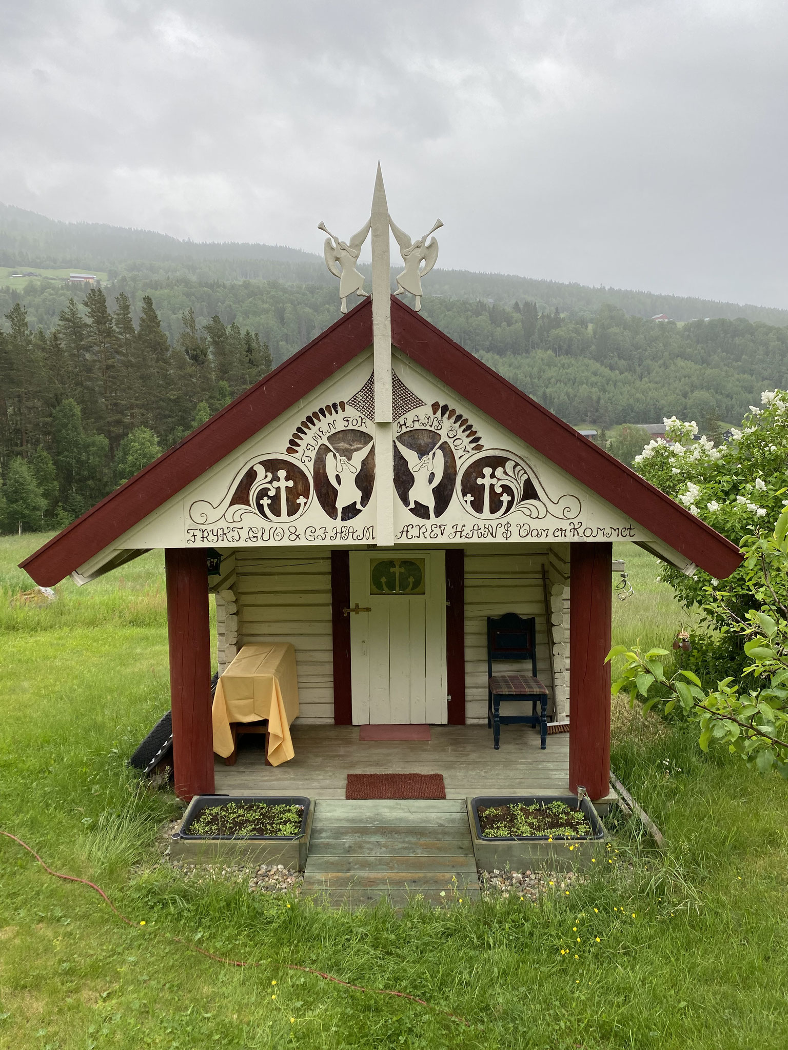
Pålerud hostel and chapel

Just a few meters behind the Fork Atrå Church/Austbygde Church you will find a sign for Pålerud Kapell og Hostel.
the Pålerud Chapel is open to visitors all year round and you are always welcome to visit it.
Please note that it is not allowed to light live candles, as in all our wooden churches. If you take this detour, you can follow the path past the chapel and hit again on the pilgrimage path to the church of Austbygde.
Håkaland - Ola- Huset

After crossing the river, turn right on the next road that leads you uphill to Håkaland.